Thursday, August 23, 2012

Rae Glacier - September 18, 2011

Rae Glacier trail details: Take Highway 40 to the Elbow Lake Day Use Area. First 1.5 km or so of the trail is to the Elbow Lake campground. Go through the campground along the south side for the trail to Rae Glacier. Trail is about 3km with an incline of about 425m.. not for the faint of heart!

Usually Nat leaves the trail selection to me. I'm a bit of a trail geek, I like figuring out the places to go and find stuff we haven't seen. But when Nat picks, it's always something off my radar, and something so damn good!

 She outdid herself with Rae Glacier. After breaking myself in post-twins with a familiar and comfortable workout, I wanted something to push me. And I wanted something we hadn't seen before.

The first part of Rae Glacier is simply the trail to Elbow Lake. Even this was new to us!

 We crossed a rock glacier a few minute in. I've seen something similar along the highway near Highwood Pass and since we were so close, this wasn't terribly surprising, but still pretty cool to look at. Didn't see any picas though.


 Ah, beautiful trail, mountains ahead, perfect hike as far as I can see...


 Approaching the lake. The hike-in campground was pretty full, and it's really easy to see why.


But we were on our way to a glacier! Somewhere over there! But first, we had to go up. Way up. Love this terrain... always reminds me I'm somewhere so few people get to be.


I have to admit it... we nearly packed it in around here. We'd been hiking on rock and shale for a good 30 minutes, and the payoff didn't seem to be much. But the people passing us and going over that little hill.... yeah, we'd come too far to turn back now.


So we made it! We got to see what remained of the glacier... which has been receding for many years now. In all my excitement, I forgot to actually take a photo of said glacier. But that's ok. It's really worth seeing for yourself. But we do have a photo of our feet. On a glacier.


Nat did take a photo, you just have to ignore the goofy looking hiker in the middle of it...


Awesome hike Nat! Keep them coming!

Thursday, July 19, 2012

Hogarth Lake - December 28, 2011 - Snowshoeing


It's been pretty warm and humid (for Alberta anyway) and it seemed like a nice time to revisit the cold, chilly climbs at the other end of the calendar. You know, to remind us why we look forward to summer so much.

I present Hogarth Lake last December.


Thursday, July 5, 2012

Fullerton Loop - August 7, 2011 (from the archives)

Elbow Valley - Fullerton Loop - The Particulars: Trailhead is located at the East side of the Allen Bill Pond parking lot (off Highway 66). Take the path under the overpass along the river to the gate. Loop is about 6.1km including the hike back to the trailhead (loop actually starts a good 1km into the hike). Trailhead elevation is about 1430m. High point is about 1585m. Loop takes about 1.5-2 hrs depending on conditions. 

The first hike I took after having the boys. Fullerton Loop is my old standby, my go to trail when the legs are weak, but I just gotta get out there and see the views:


That's Moose Mountain as seen from Fullerton Loop. I haven't been back yet, but one day....

Monday, June 25, 2012

Bow Falls - May 5, 2012


It was a banner moment for the HipHiker household. The moment when our family hiking group no longer consisted of two pairs of feet along the dusty trail... but four.

Ok, so at 14 months (at the time), the boys weren't going to be kicking up too much dirt in their Stride-Rites, but it was time to see if they wanted to come along for the ride, so to speak.

Buying child carriers was a foregone conclusion for our family until a couple of friends mentioned their kids did not take kindly to the backpacks. Dropping $200+ (times two!) for something we might never get to use wasn't terribly appealing. I was lucky enough to find out the local twins club (Twins, Triples and More Association of Calgary) had loaners. We borrowed them for a few weeks, and started light.... Bow Falls in Banff.

Despite being twins, my boys are nothing alike. Benjamin is my outdoorsy kid, he'll giggle in a snowstorm and turn his head to smile into the wind. But he has never liked any carrier contraption we've put him in. He hated the wrap and barely tolerated a Snugli. Joshua on the other hand doesn't seem to relish the elements as much, but is good to go with any mode of transport. I was curious to see what this combination of personalities would bring to the trail.

Though they began with a lot of crying, once they were lifted onto our backs and realized how much they could see and touch, they got into the hike. Once they reached out and started touching trees.... nothing but smiles.

Not a bad way to start your hiking career... and not a bad view either...


Hitting the trail! Benjamin was already mesmerized by the view...


Now we just need to find time to buy child carriers of our own.

Wednesday, June 20, 2012

A drive along Highway 66 -- July 11, 2010 (from the archives)

Not every venture out to the mountains is for hiking. Sometimes we just want to take in the scenery with friends.

I didn't know it at the time, but this would be my last hike pre-babies, and it wasn't even a hike. Some friends were here from Winnipeg. One had grown up in Calgary and wanted to see some of the old sites. So Elbow Falls, Forget-Me-Not-Pond, some rock skipping into the Elbow River, and a memorable day was made...


Wednesday, June 13, 2012

Ford Knoll - July 2, 2010 (from the archives)

We rarely ever see anyone else on Ford Knoll, even though it's right next door to a very popular campground. We never see a single soul on cloudy and rainy days. But the world never looks as vibrant as it does on a rainy day....


Saturday, June 2, 2012

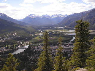
Tunnel Mountain - June 26, 2010 (from the archives)


Banff National Park tweeted earlier this week that a number of Banff area trails are now snow free, including Lake Louise Shoreline, Glacier Lake Trail, Johnston Canyon, Bow River Loop, and Castle Lookout. This got me thinking about Tunnel Mountain Trail, a good trail for getting the hiking blood flowing and getting your first good views of the post-winter Banff landscape.

It's a great short hike, especially if you haven't warmed up those hiking legs yet. Even if you're not in peak form, it takes about 45-60 minutes to reach the top without pushing you beyond your limits, and gives you a little bit of rocky terrain near the top to whet your appetite. There's lots to room to stretch out in the sun at the top and enjoy the views.


I can never get enough of the views of Mount Rundle... right next door.